Educating Harlem
A Century of Schooling and Resistance in a Black Community

Maps


Please note that these maps to do not offer a comprehensive portrayal of Harlem’s educational landscape. They show those sites that receive substantial discussion in the chapters in this volume.

Locations that appear in chapters 1 through 6

Map of locations that appear in chapters 1-6


Locations that appear in chapters 7 through 13
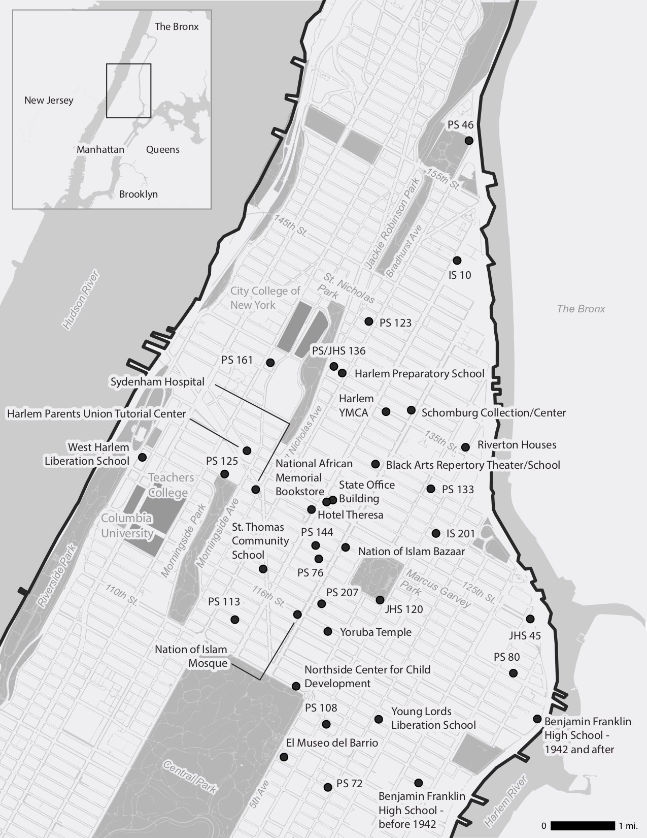
Map of locations that appear in chapters 7-13


Map design by Rachael Dottle. Map research by Rachel Klepper. Map layers from: Department of Information Technology and Telecommunications, Department of Urban Planning, City of New York; Atlas of the city of New York, borough of Manhattan. From actual surveys and official plans / by George W. and Walter S. Bromley New York Public Library Map Warper; Manhattan Land book of the City of New York. Desk and Library ed. [1956]; New York Public Library Map Warper; and State of New Jersey GIS. Point locations from: School Directories, New York City Board of Education, New York Amsterdam News via ProQuest Historical Newspapers, and multiple archival sources cited in relevant chapters.