Race, Ethnicity, and Nationality Maps
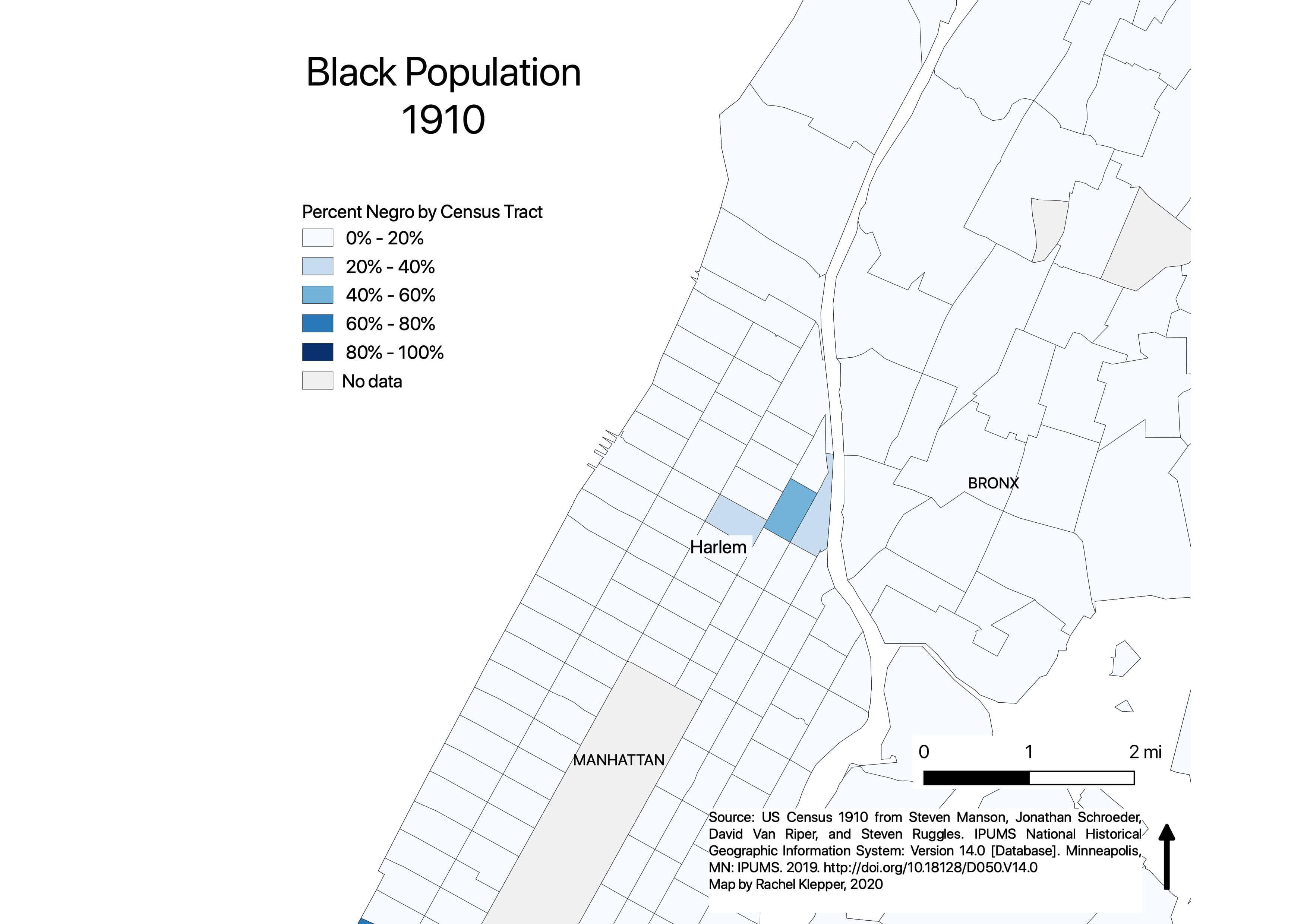
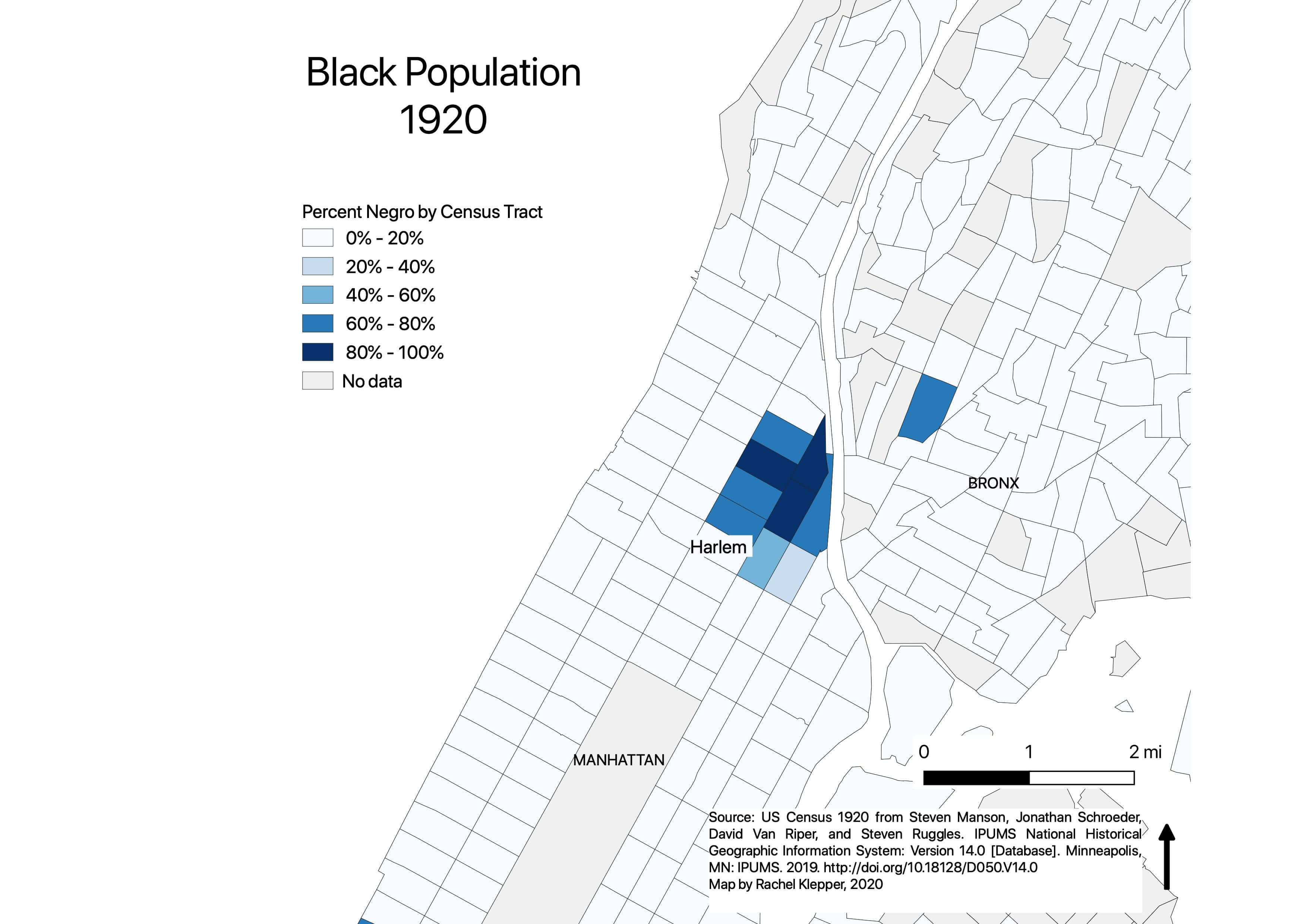
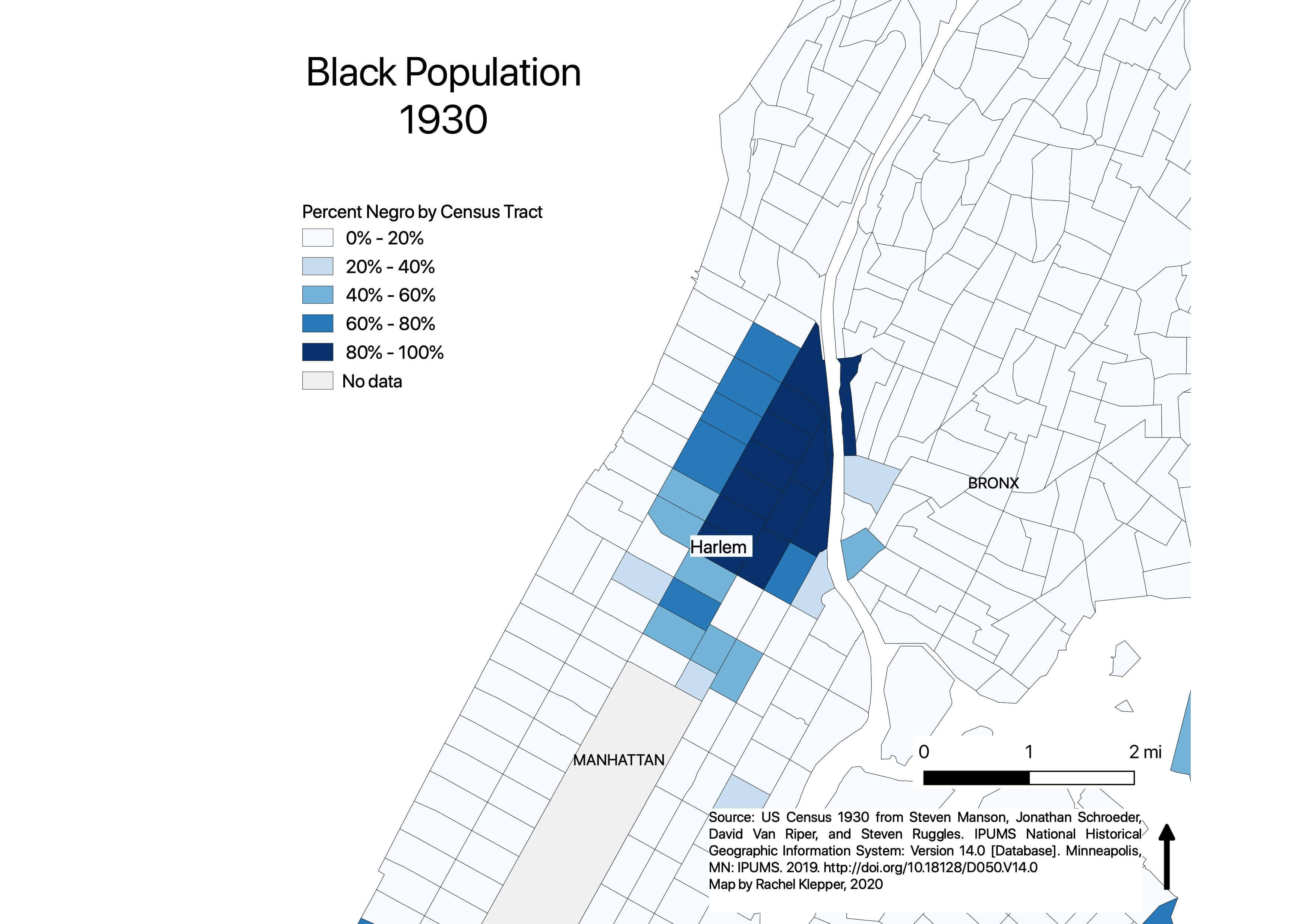
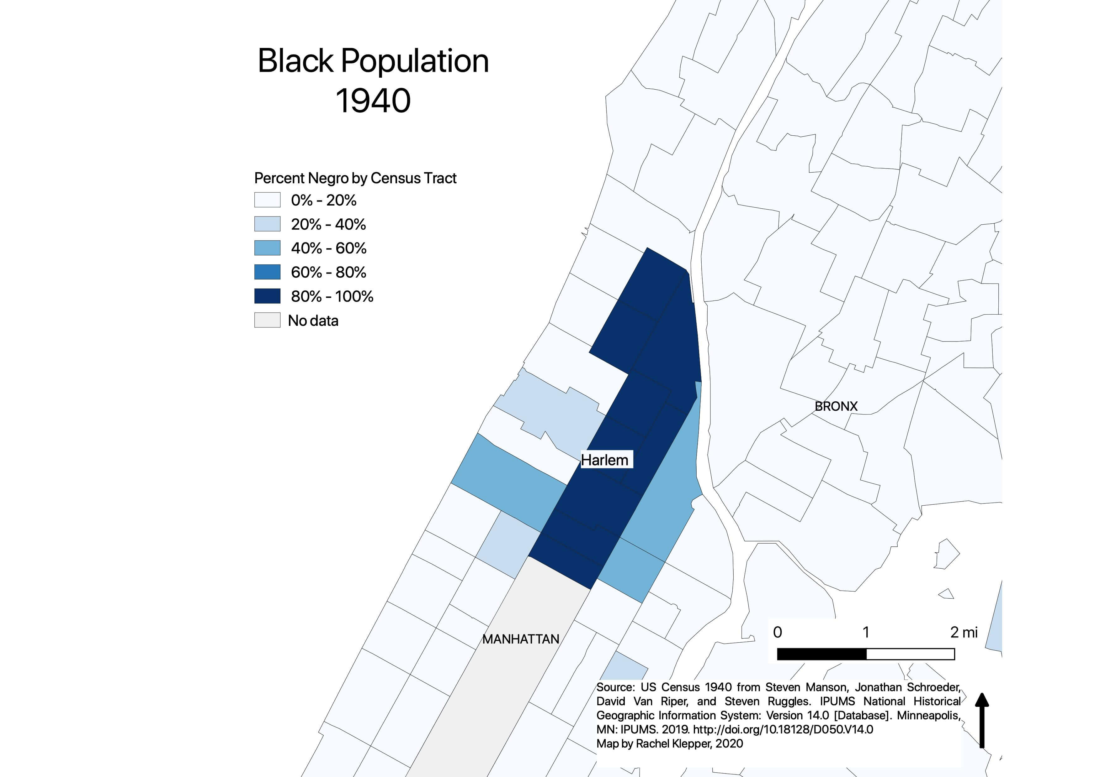
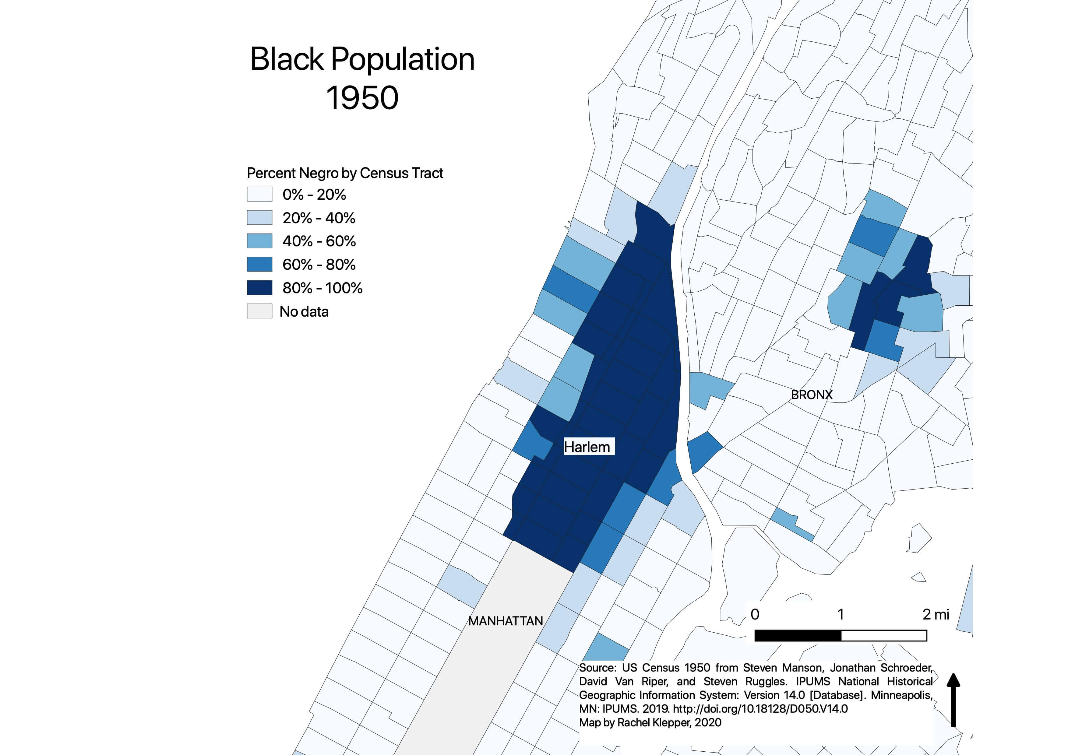
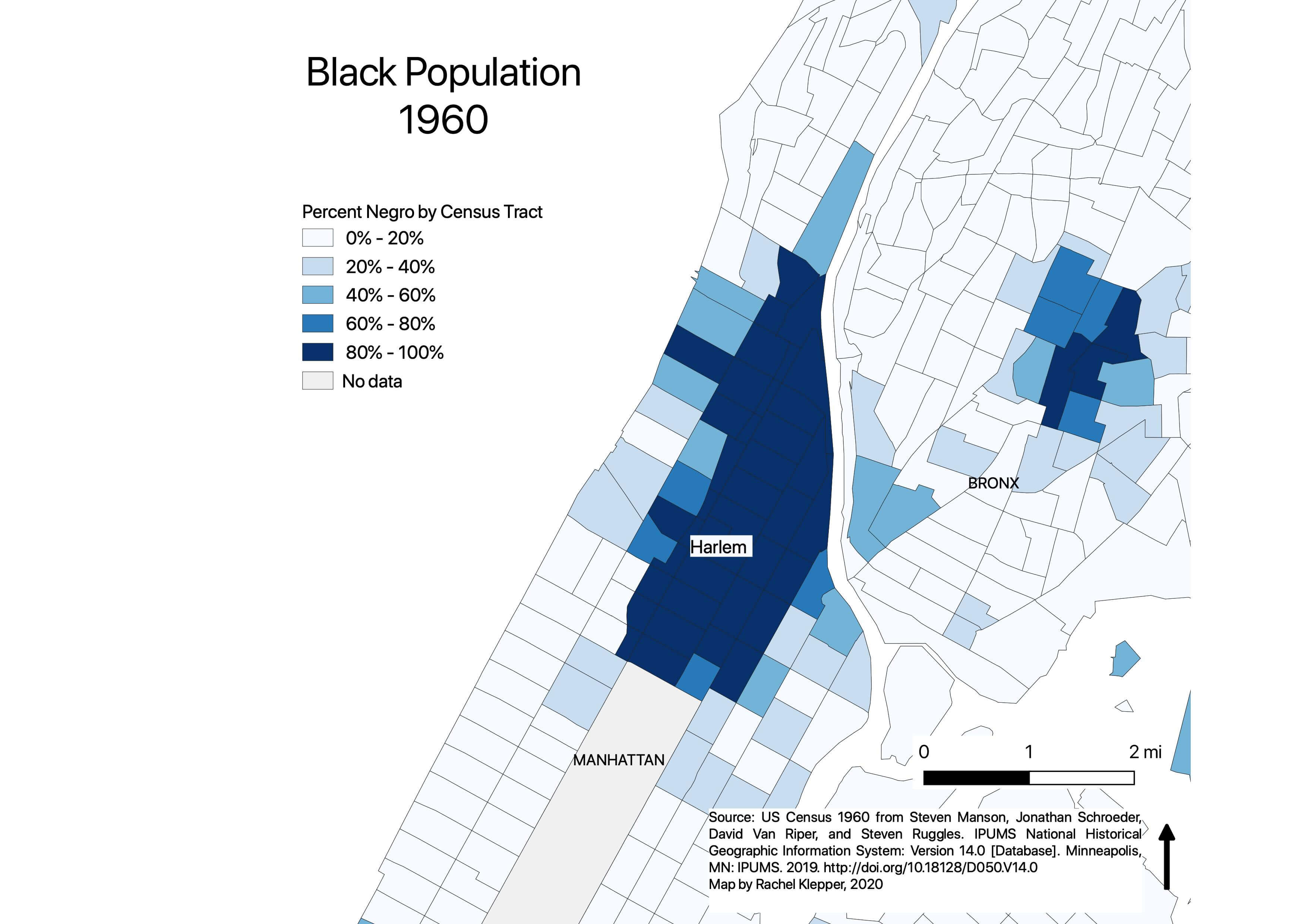
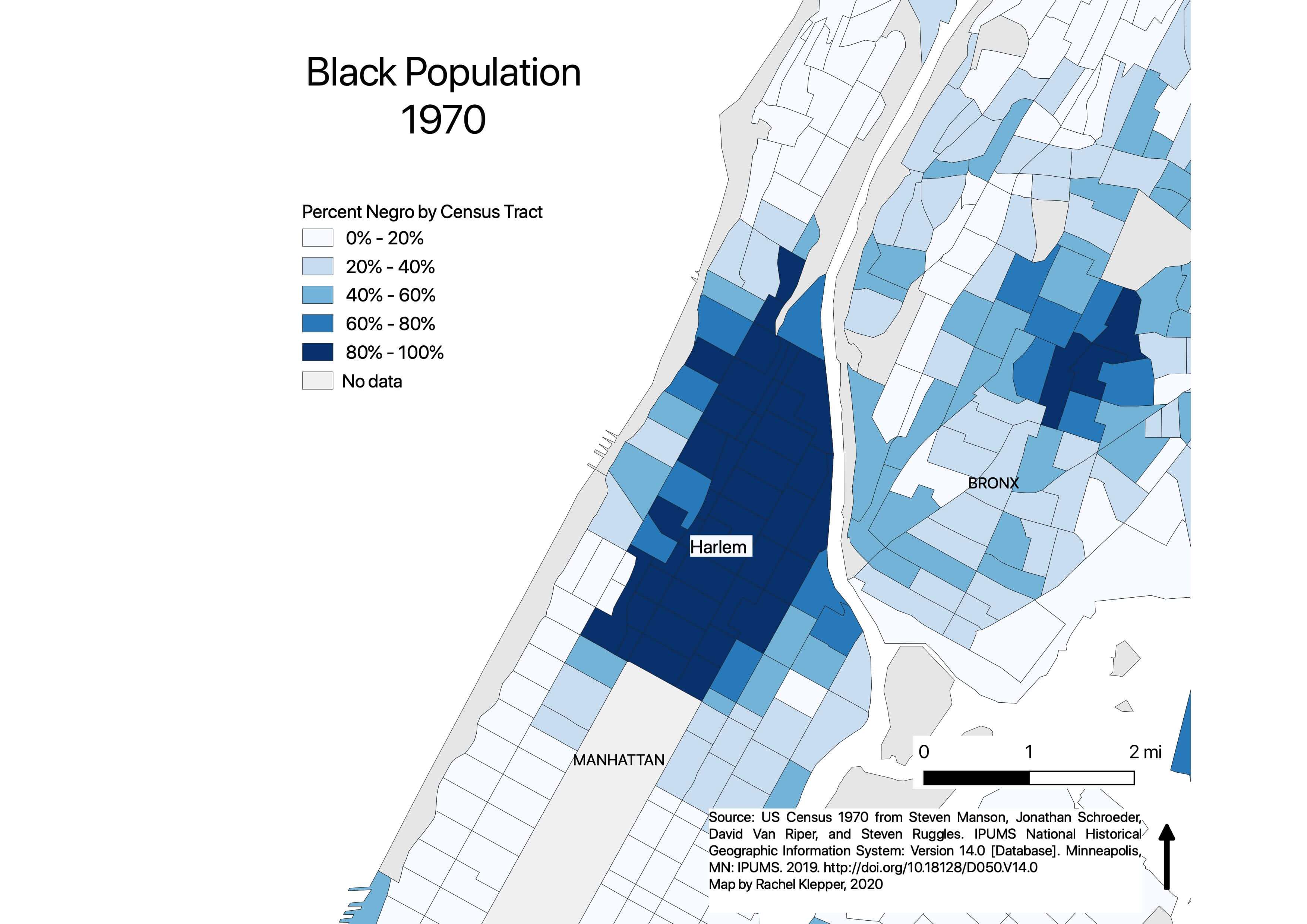
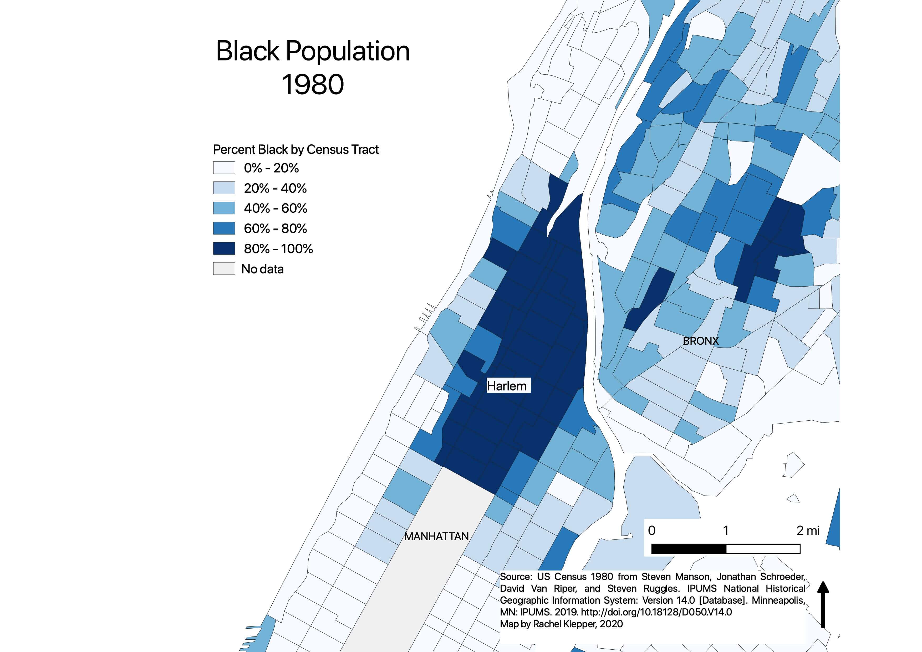
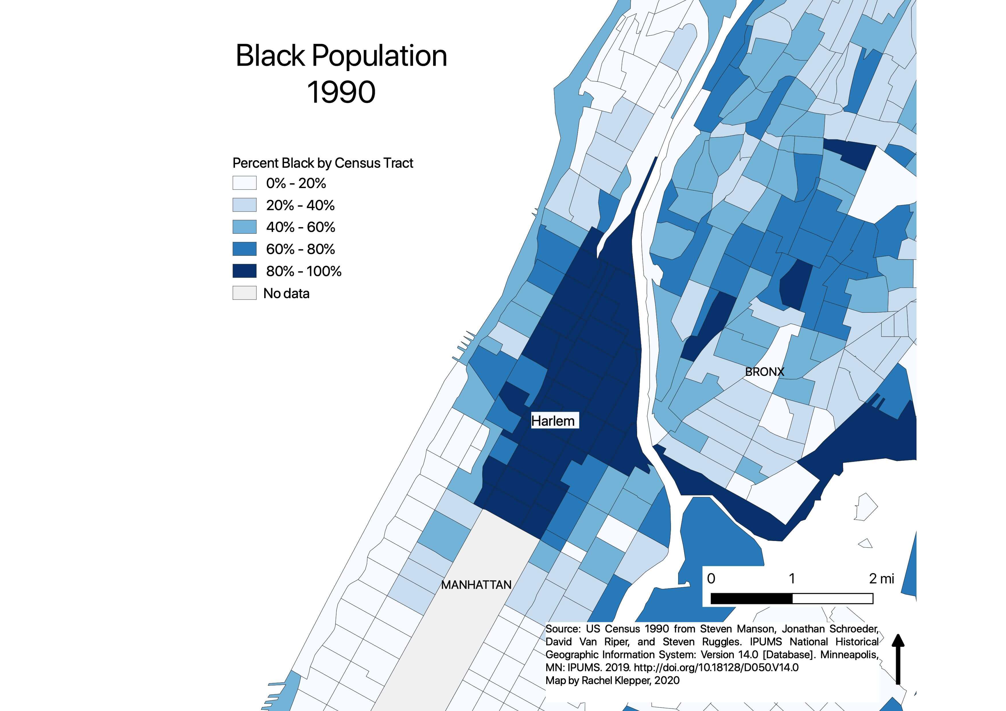
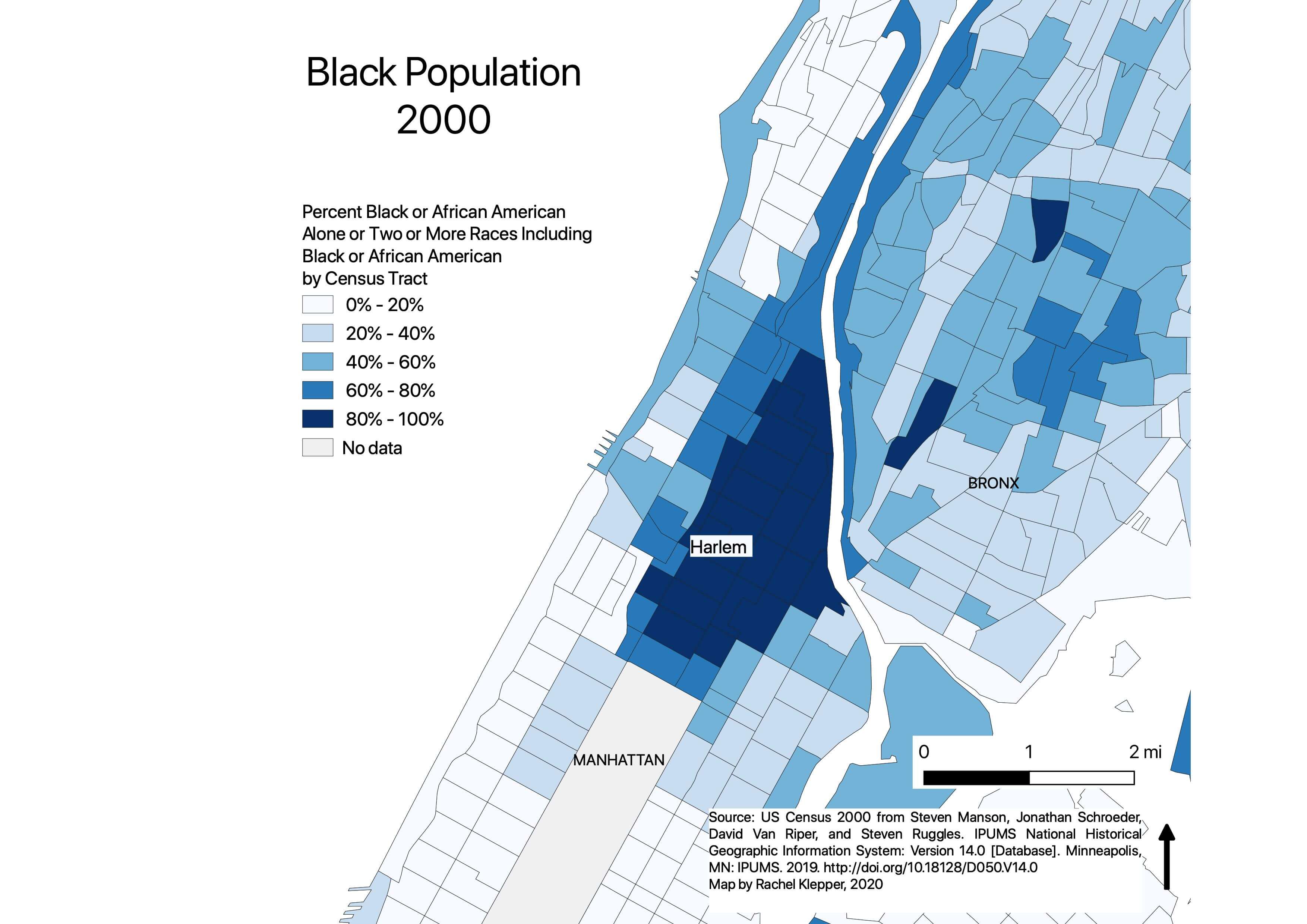
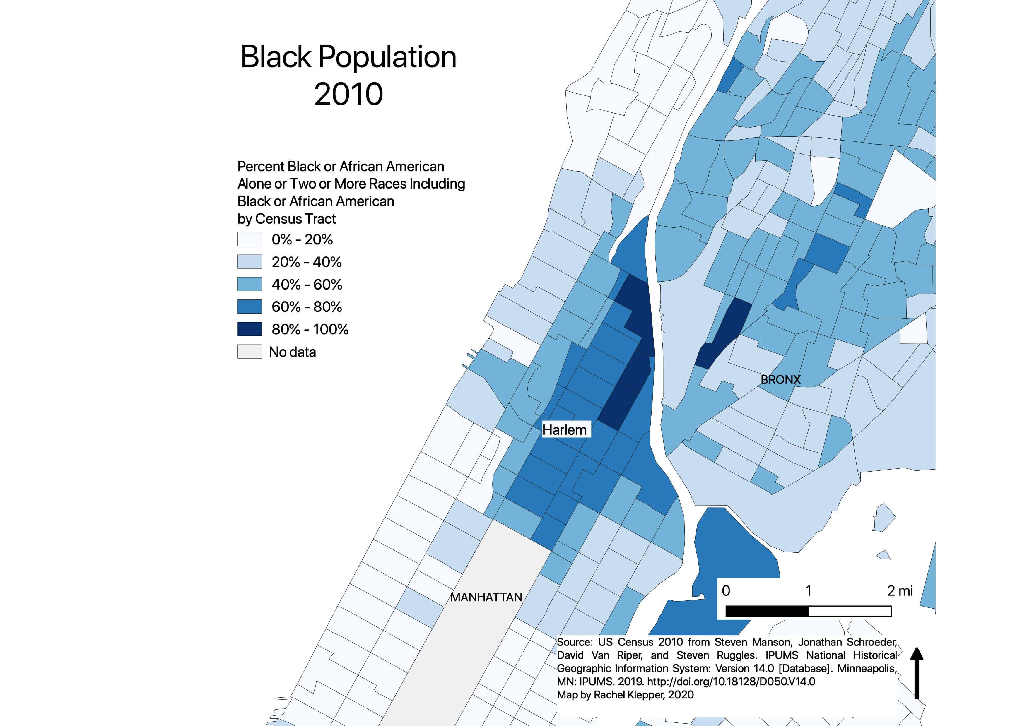
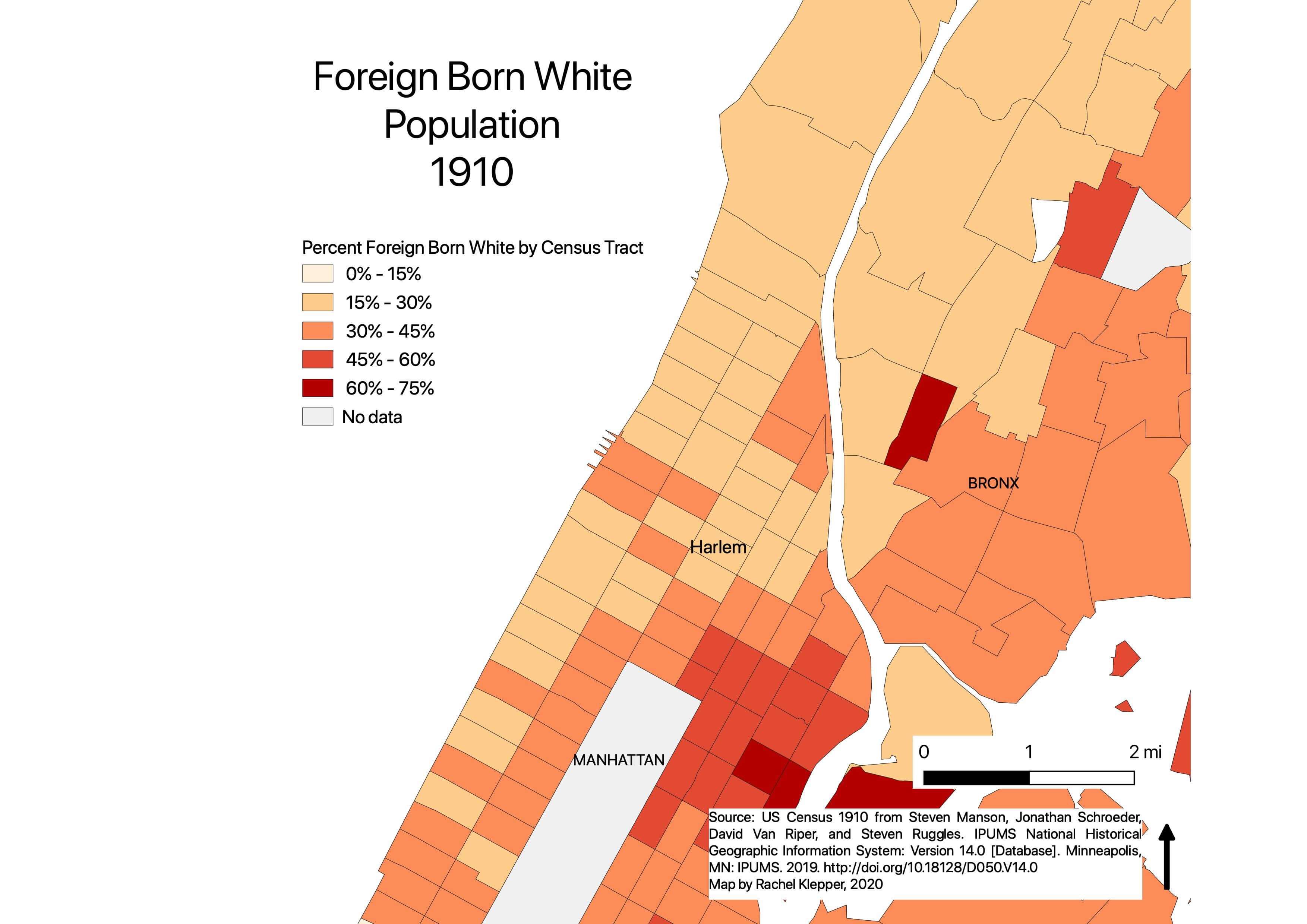
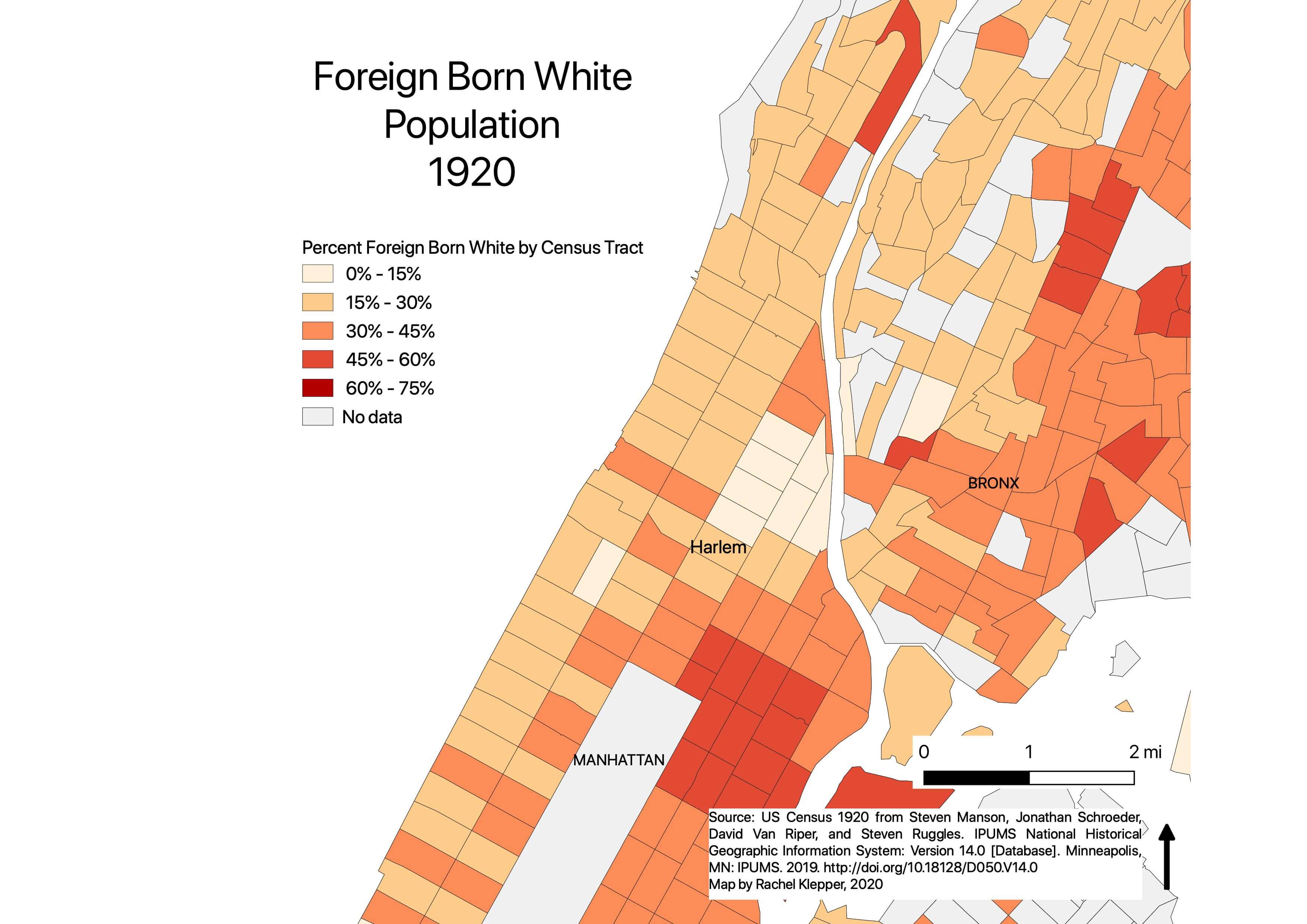
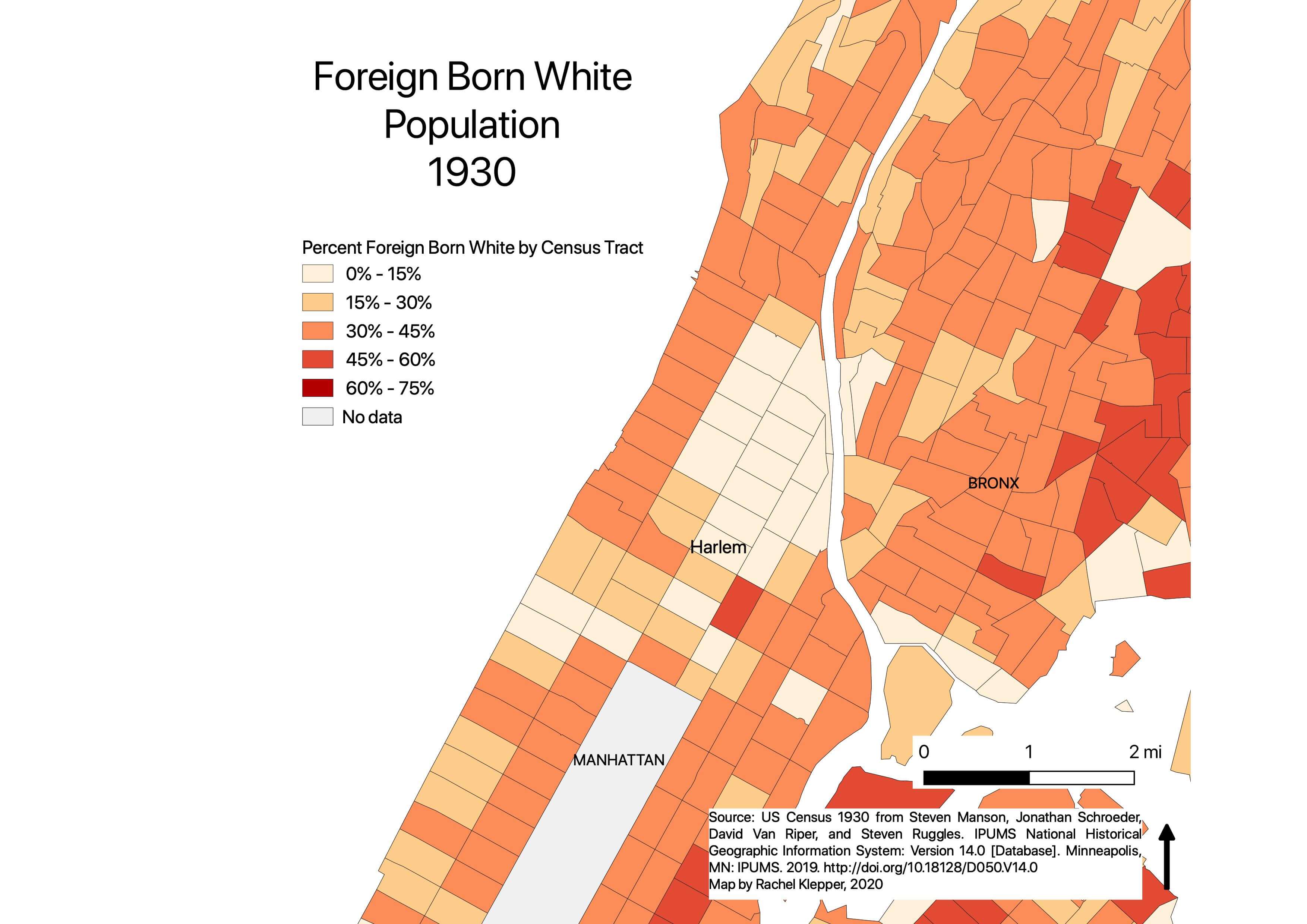
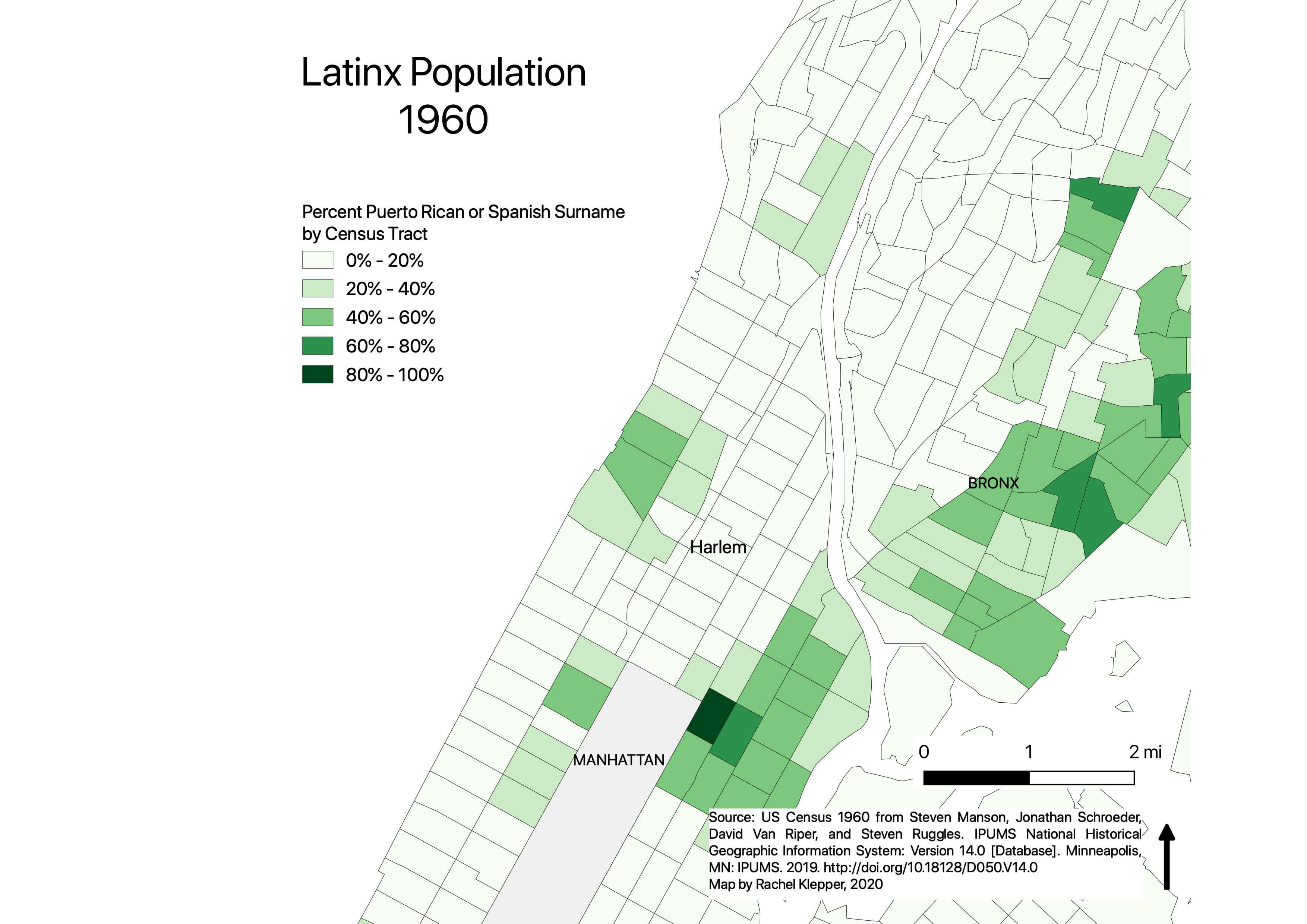
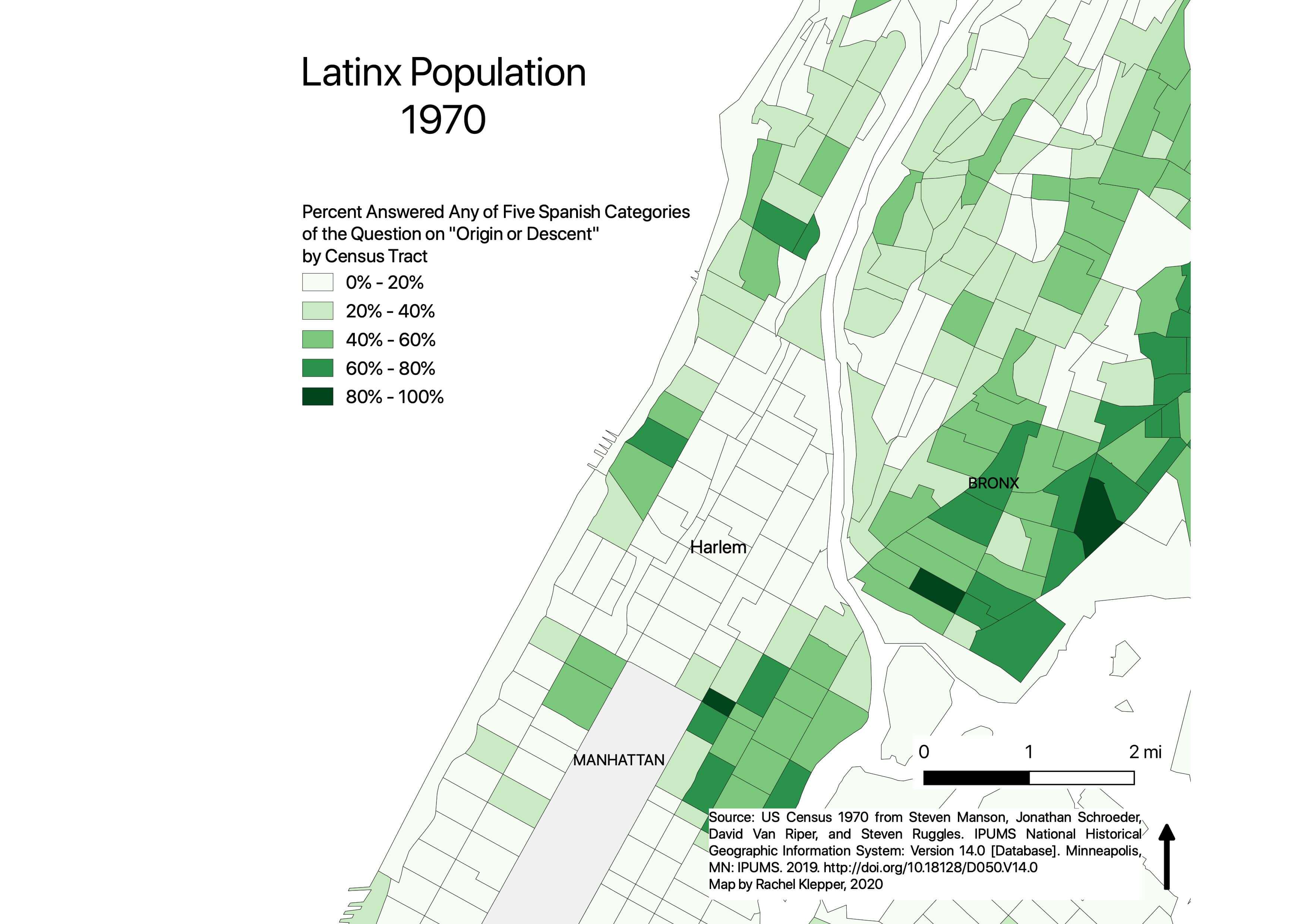
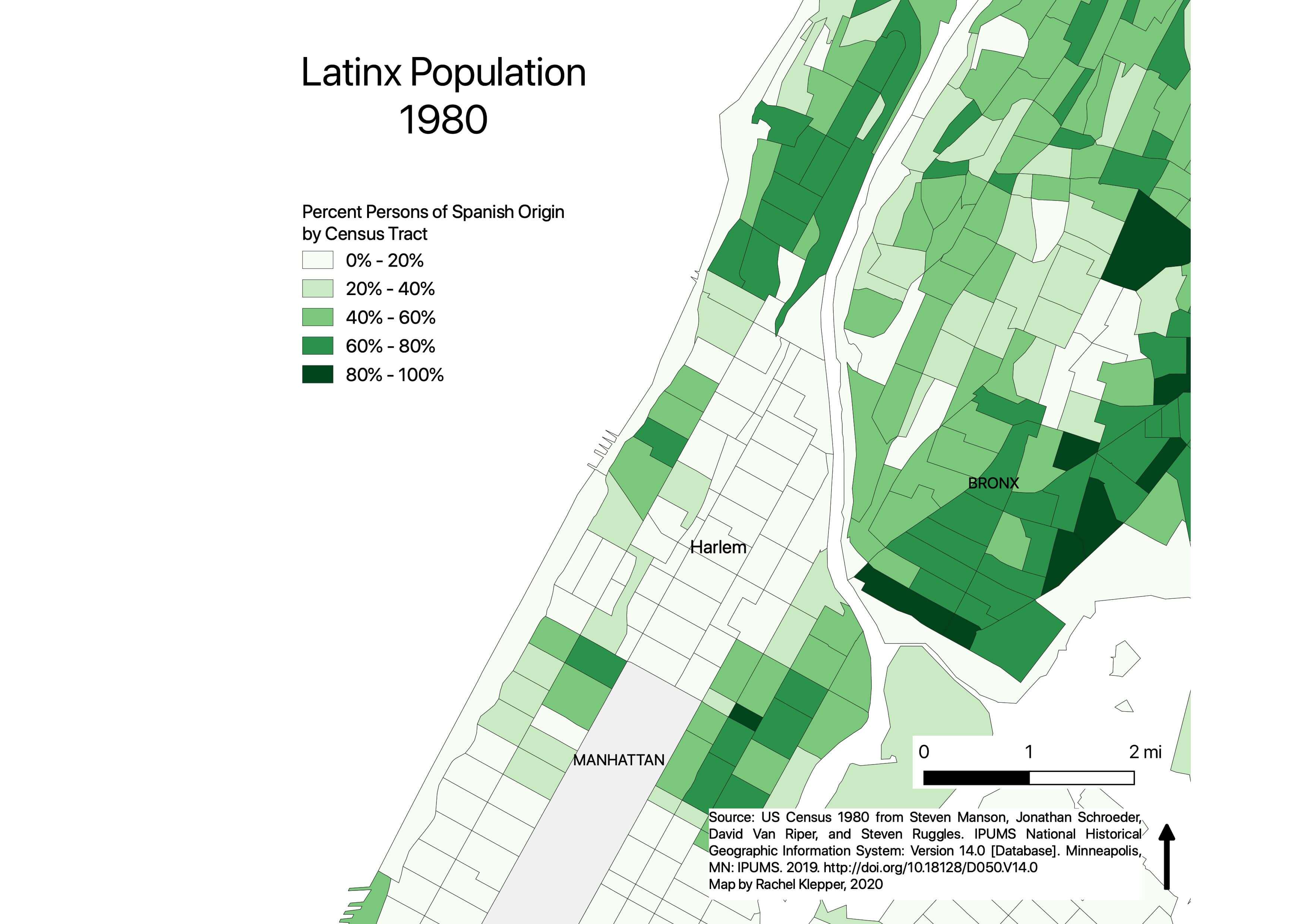
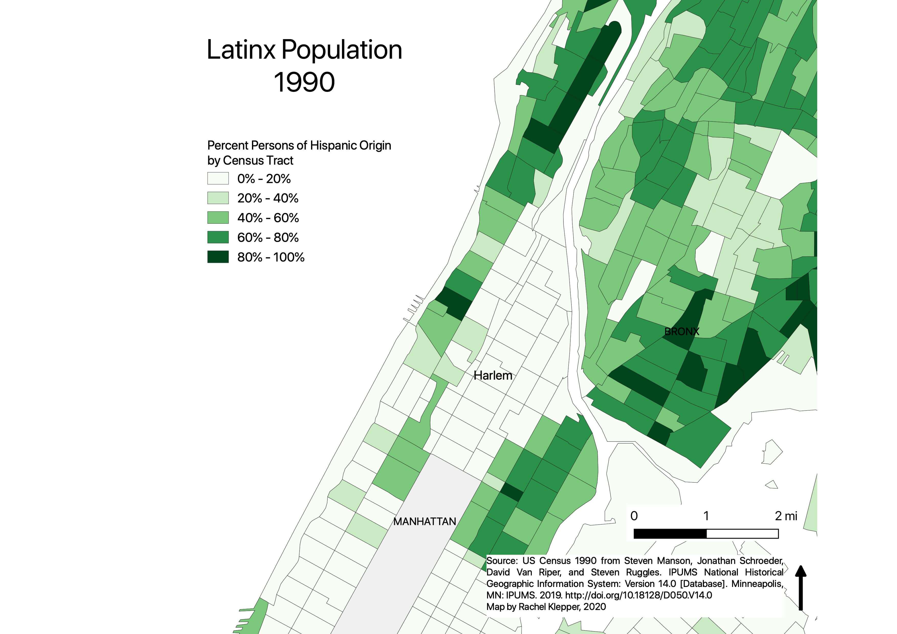
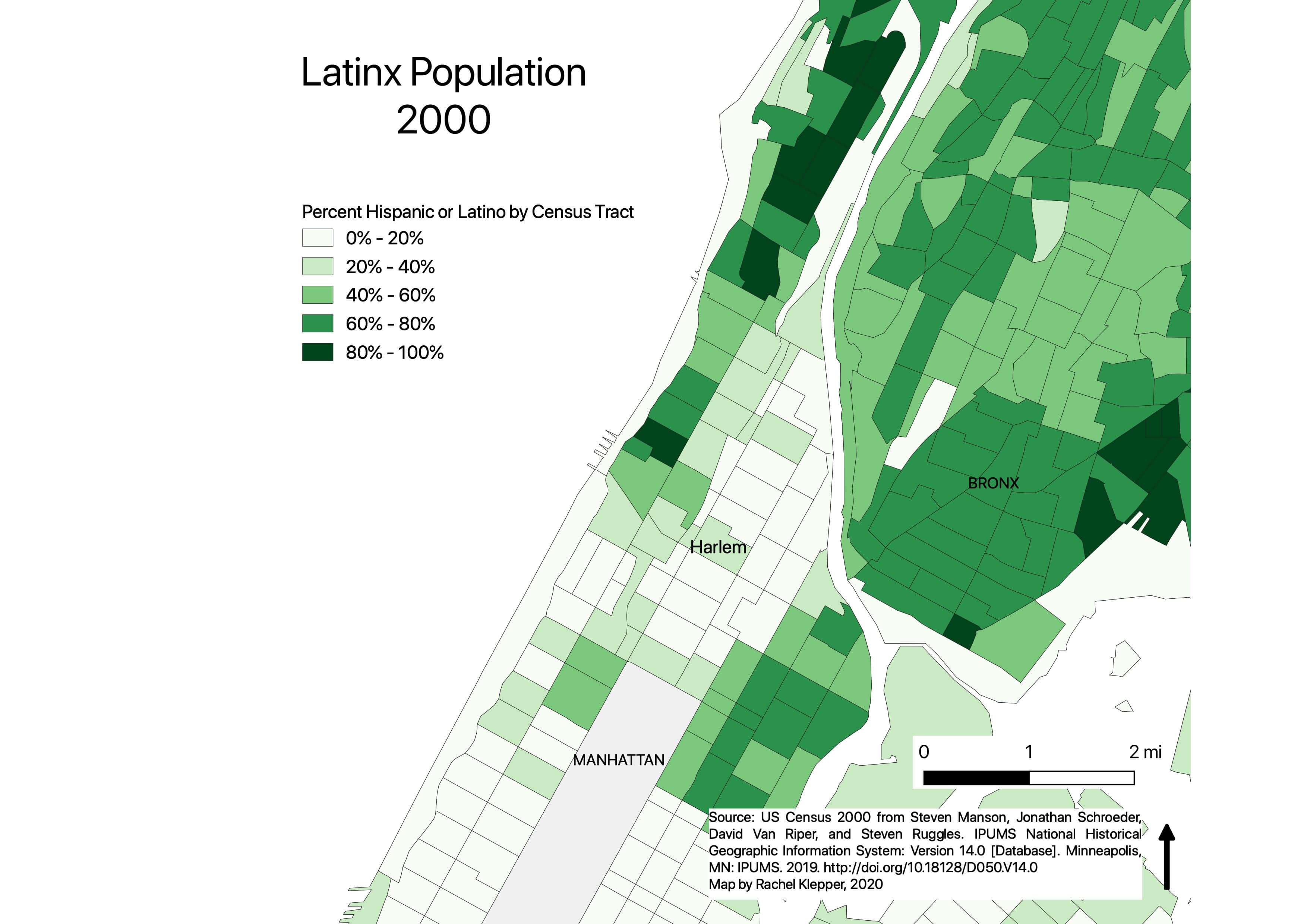
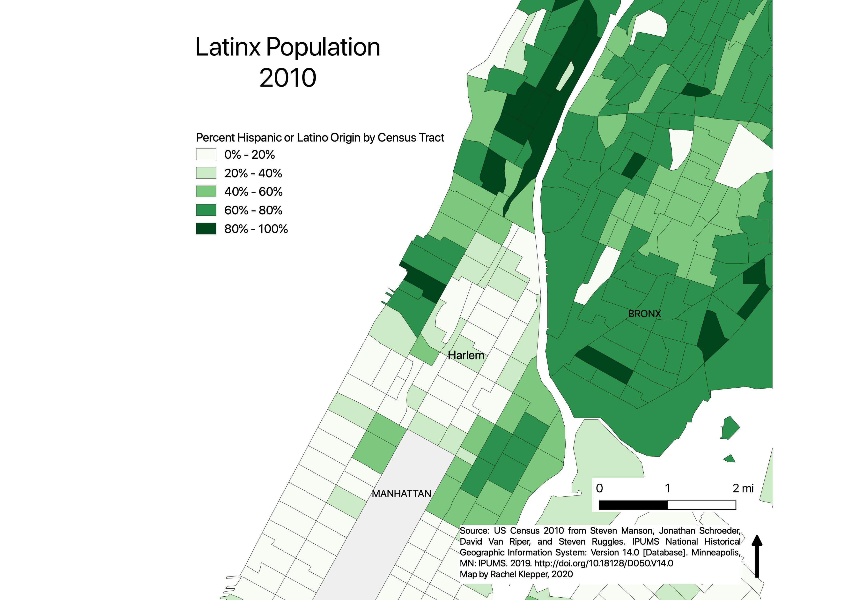
These maps use census data from 1910 to 2010 to visualize changes in the race, ethnicity, and nationality of Harlem’s residents. Read alongside the chapters of Educating Harlem, they help document themes such as the formation of Black Harlem, the presence and then decreasing population of white European immigrants (mostly Italian and Jewish Eastern European) in the early twentieth century, and Puerto Rican migration to East Harlem. Three series of maps are organized by year, including:
- Black Population (1910-2010)
- Foreign Born White Population (1910-1930)
- Latinx Population (1960-2010)
The racial and ethnic categories used by the census have changed over time, and are limited in their descriptions of individuals’ and groups’ identities or backgrounds. While we have titled maps consistently as depicting “Black population” or “Latinx population,” the terminology listed in the legend reflects the categories used in each year’s census. Latinx groups were only recorded beginning with the 1960s census and were counted separately from race. There is overlap between the Black and Latinx populations, with Latinx New Yorkers also identified by race as white, Black, or other.
For a detailed list of the categories used each year, see Measuring America: The Decennial Census from 1790-2000. For more background on the census and race in Harlem, see Michael Soto’s Measuring the Harlem Renaissance: The U.S. Census, African American Identity, and Literary Form.
Click on each map to view it in a larger window.
